Cartography's Next Frontiers April 2016
Want more free featured content?
Subscribe to Insights in Brief
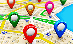
During the past decade, Scan™ has looked at various aspects of and challenges for cartography. Accurate and reliable information about infrastructure elements, the movement of people and objects, and a range of other phenomena are important for a variety of applications. Maps are enablers of commercial applications; therefore, improved mapping and new types of maps directly expand existing applications and create new opportunities.
Mapping and navigation applications that rely on GPS have become very accurate, and manufacturers equip most smartphones with GPS technology; however, GPS does not work well indoors, providing inaccurate or only approximate information about users' indoor location. Several organizations are experimenting with various technological approaches to enable effective mapping and navigation within buildings and facilities. For example, researchers at the Fraunhofer Institute for Photonic Microsystems (Fraunhofer Society; Munich, Germany) have developed an app that leverages information from WLANs (wireless local-area networks) to enable users to navigate rooms, hallways, and floors in buildings to find their destination. The app uses the signal strength of WLAN spots to determine the user's position within about 2 meters. In contrast, the University of Lodz (Lodz, Poland) installed a special infrastructure to help students navigate its campus and facilities throughout the city of Lodz. The university worked with navigation-solutions developer Linteri (Warsaw, Poland) to install Bluetooth-enabled beacons across its premises that enable students to receive directions and manage their schedules.
Advanced maps enable applications to leverage infrastructure elements and features.
Other challenges exist. As a future of self-driving vehicles becomes increasingly plausible, new types of cartography will become necessary. At the end of 2015, Nokia's (Espoo, Finland) mapping division Here saw acquisition by a consortium comprising Audi (Volkswagen Group; Wolfsburg, Germany), BMW (Munich, Germany), and Daimler (Stuttgart, Germany). The company is working on maps that are usable by both human drivers and autonomous vehicles. Humans can absorb and process a limited amount of information, so maps for humans must represent only the most relevant data. In contrast, computer systems can make use of a vast inflow of information in real time, so maps for such systems can include highly detailed data to serve a wide variety of applications and improve accuracy. The maps Here is developing will cater to the capabilities of humans and to the capabilities of machines.
Some areas of the world remain insufficiently mapped—in fact, scientists have mapped the surface of Mars more thoroughly than they have mapped Earth's ocean floor. In December 2015, the XPrize Foundation (Culver City, California) announced the Shell Ocean Discovery XPrize—a new competition to map the ocean floor. The XPrize Foundation partnered with Royal Dutch Shell (The Hague, Netherlands) and the US National Oceanic and Atmospheric Administration (US Department of Commerce; Washington, DC) to offer a $7 million prize purse. The aim of the competition is to develop "solutions that advance the autonomy, scale, speed, depths and resolution of ocean exploration" (http://oceandiscovery.xprize.org).
Layering environmental data on top of topographical maps can expand the maps' functionality. Although researchers usually engage in such mapping efforts with one specific application in mind, the rich and textured maps they create often enable a variety of additional applications. Environmental-sensor manufacturer Aclima (San Francisco, California) recently formed a partnership with Google (Alphabet; Mountain View, California). Aclima is providing air-quality sensors for the cars that Google uses to map streets for Google Street View. The pollution information the sensors gather will then appear on Google Maps and Google Earth Engine. Google began deploying the sensor-equipped cars in California in 2015. California regulators believe the new data could augment information they collect from the state's existing stationary pollution monitors and hope that comparing the various data sets will provide a more comprehensive overview of pollution across the state. Meanwhile, nonprofit organization Freshwater Trust (Portland, Oregon) is focusing on mapping the pollution levels of river systems. The organization is working with Google to map US waterways with advanced cameras. A Freshwater Trust team attached a Trekker—one of the high-tech cameras Google uses to create maps for Google Street View—to a raft and rode the raft down 60 miles of the Russian River in California. The team uploaded the Trekker photos from the trip to Google Maps, which essentially created a virtual tour of that section of the river. Researchers can use this process to assess the condition of waterways by looking for debris and pollution in the images the Trekker captures. The pictures reveal, for example, stacks of crushed cars at riverbanks and the presence of Arundo—a nonnative grass that is affecting native wildlife.
Other systems capture data about less tangible environmental factors. For instance, Massachusetts Institute of Technology (Cambridge, Massachusetts) spin-off Essess (Boston, Massachusetts) is using car-mounted imaging equipment to create heat maps of buildings. A single car can image thousands of buildings in an hour, identifying sources of heat loss and enabling building owners to take steps to mitigate that heat loss. The start-up firm is working with utilities companies and government departments to identify individual homes and buildings that are losing large amounts of heat. Essess's software analytics incorporates household information and demographic data to determine the likelihood of homeowners' making alterations to their houses to improve energy efficiency. Meanwhile, a group of researchers, which includes renowned computer scientist Daniele Quercia, is exploring the use of social media to create smell maps of urban environments. During her previous work, researcher Kate McLean enlisted volunteers to write down words that describe the smells they encountered during walks in several cities. These words served as the basis for the creation of an urban-smell dictionary. The group of researchers then searched social-networking websites such as Instagram (Facebook; Menlo Park, California) and Twitter (Twitter; San Francisco, California) for Barcelona, Spain, and London, England, collecting georeferenced tags from photos and georeferenced tweets. After matching these georeferenced tags and tweets with words in the urban-smell dictionary, the researchers developed a ten-category classification system for smell-related words and used this system to create smell-category maps for the two cities. The researchers hope to highlight smell as an additional type of information that urban planners can employ while designing cities.
Advanced maps enable applications to leverage infrastructure elements and features, and cartography's increasing accuracy will enable developers to create a variety of new applications. In addition, topographical maps can serve as a platform for an expanding range of information layers, enabling the emergence of completely new applications. As cartography advances, the number of companies that benefit will increase.